
vector-datasource
Tilezen vector tile service - OpenStreetMap data in several formats
OTHER License
-
Release date: 2023-03-10
-
Requires: tileserver v2.2.0 and tilequeue v2.5.0 and rawr_tiles v1.1.0 and coanacatl v1.0.0
-
Credits: @travisgrigsby, @jeffdefacto, @peitili, @iandees, and @nvkelso
ENHANCEMENTS
-
Significant performance improvements to reduce p99 file sizes globally (-45%) at all zooms to under 200 kb, with some improvements for low-zoom p50 sizes. Changes include: geometry simplification at low zooms, pushing some features like unclassified roads to the next zoom, dropping names on short lines and dropping other properties at mid-zooms to also allow more aggressive merges to multi-lines and multi-polygons, and more sophisticated handling of max zoom and overzoom tiles for buildings and addresses. Further reductions can be achieved by configuring Tapalcatl to selectively drop layers and name translations (eg to drop
earthandtransitlayers or only keep English and Urdu names) depending on your business needs.

(Above) Chart shows sizes in kilobytes, based on commonly requested top 100,000 tiles at 512 pixel zooms. NOTE: all other zooms in this document use nominal 256 pixel zooms, offset by 1. - Internationalization is now feature complete by extending disputed boundary point-of-view handling fully into mid- and high-zooms with extensive paired data edits upstream in OpenStreetMap, using Natural Earth as a sanity check for country names, and consideration of common and less common edge cases, including Taiwan and Somaliland.
- MapLibre support with buffered tiles and connivence properties like pre-calculating shield text length allow Tilezen tiles to more easily be styled in MapLibre and MapboxGL, thus extending support beyond Tangram.
-
boundaries: Add disputed boundary line point-of-view (POV) for mid- and high-zoom features sourced from OpenStreetMap (OSM), including extensive upstream editing in OSM to match Natural Earth's low-zoom disputed area modeling in earlier releases. New
unrecognized_disputekind anddisputed_byproperty. (Issue #1901) -
boundaries: Add missing Cyprus line-of-control (aka "green line") as it has custom
admin_leveltagging. (Issue #1898) - boundaries: Add Ukraine point-of-view for disputed boundaries. (Issue #1911)
- boundaries: Add disputed boundary in South China Sea scoped to China's point-of-view (POV). (Issue #1983)
-
boundaries: Mark some Natural Earth low-zoom boundaries as default
unrecognized, including for Abkhazia, Donbass, Nagorno-Karabakh, Northern Cyprus, Somaliland, South Ossetia, and Transnistria. (Pull request #2072) - buildings: Add additional non-OpenStreetMap buildings from the Microsoft sidecar in Daylight distribution.
-
places: Always validate OpenStreetMap-sourced
country,dependencyanddisputedlabels against Natural Earth and new ISO and TLC point-of-views. (Issue #2075, #2076, and #2077 and pull request #2069) -
places: Add recasted Australia "suburbs" from OpenStreetMap as
localityfeatures to match local expectations. (Pull request #2070) -
places: Improve continuity between Natural Earth and OpenStreetMap (OSM)
localityfeatures and theirmin_zoomgrading. (Issue #2020) -
places: Join OpenStreetMap
localityfeatures with Natural Earth (NE), and prefers NE names to improve consistency across the zoom transitions. (Pull request #2088) -
places: Join OpenStreetMap
localityfeatures with Natural Earth (NE), and prefers NE population to calculatepopulation_rankfor label grading. (Issue #2048) -
places: Backfill
populationestimates for OpenStreetMap-sourcedlocalityfeatures. (Issue #1992) -
places: Cull
localityandneighbourhoodfeatures based on grid to right size tile payload to rendered features. (Issue #1999) and issue #2040) -
pois: Add optional
directionproperty, an integer indicating degrees from 0-359, forviewpointkind features. Thanks @rwrx. (Issue #598 and pull request #1916) -
roads: Calculate new
shield_text_lengthproperty to ease styling of road shields in MapboxGL-based map styles. (Issue #1979) -
water: Add
kind_detailfor polygon features, with values including:basin,canal,ditch,drain,lake,river, andstream. (Pull request #2047) -
water: Mark water polygon feature as
kind_detail=lakewhen upstream OpenStreetMap value islagoon,oxbow,pond,reservoir, orwastewater. (Pull request #2047) -
water: Add optional
layerproperty for complicated over-under rendering situations, with adjustedsort_rankfor some features. (Issue #1910) - all layers: Switch to Daylight distribution for ingesting OpenStreetMap planet files, including building and admin sidecars. WARNING: Some OSM feature IDs may be re-numbered. (Pull request #2085)
- all layers: Upgrade to Natural Earth to v5.1.2, circa May 2022 (Issue #2074)
- earth: Upgrade to osmdata.openstreetmap.de circa October 2021.
-
places: Upgrade to Who's On First
neighbourhoodfeatures, circa October 2021. - all layers: Add MVT buffer support to enable MapboxGL to render stroked lines at tile boundaries without missing triangles (eg for road casings). Tilequeue #401
-
all layers: Vary the MVT tile
extentso 8192 is only used onmax_zoom(and 4096 earlier) to optimize file size while preserving overzooming. (Issue #1985) - all layers: Are now MVT v2 spec compliant, via related changes in Tilezen's mapbox-vector-tile v2.0.0 release.
BUG FIXES
-
boundaries: Show all missing
disputedlines for point-of-view (POV) in low-zooms (removemin_zoomfilter). (Issue #1970) -
boundaries: French
regionlines show too early, switch all from funkyscale_rankmapping to Natural Earth'smin_zoomproperty. (Issue #2062) - boundaries: Drop additional ID and name properties at mid-zooms and merge lines at high-zooms. (Issue #2007)
- boundaries: Revert poor tolerance config change from earlier release, this improves visual look for 512-pixel tiles in MapboxGL-based styles. (Issue #1980)
- boundaries: Fix some incorrectly marked maritime boundaries with new buffered land masking file. (Pull request #2073)
-
buildings: Add
root_id=idto simplify MapboxGL-based styles. (Issue #2092) - buildings: Remove small buildings, reduce building geometry details, and remove some properties at mid- and high-zooms. (Pull request #2052)
-
buildings: Ensure
addresspoints always have amin_zoomproperty (eg of17for generated address points). This is paired with a Tilequeue change to drop zoom 17 features from 512-px tile sized zoom 15 tiles to reduce tile size. (Issue #2023) and (issue #2032) - landuse: Drop properties at low- and mid-zooms to encourage more feature merging. (Issue #2009)
-
landuse: Show more medium-sized
parkpolygons in cities at mid-zooms. (Issue #1995) -
landuse: Tunnels for
canalshould draw underpedestrianplaza so adjustsort_rankfor these and some other kinds. (Issue #1910) -
landuse: Switch sourcing of
resortupstream in OpenStreetMap to leisure from tourism. -
roads: Remove
nameproperties from short road segments where they don't have enough room to label. (Issue #2019) -
roads: Adjust zooms for regional and local cycle network influenced features one zoom later. Drop more
all_networksandall_shield_textsfor more zooms. Drop more bus, walking, and bicycle network properties at low- and mid-zooms. Drop general road shield properties at earlier zooms by kind. Drop other properties at earlier zooms. Selectively droplanduse_kindfrom mid-zooms by kind. Shiftunclassifiedroadsmin_zoomback to 12 from 11 as that's more common outside the USA than previously explored and negatively affected tile size. (Issue #2008) -
roads: Remove additional low- and mid-zoom
ferryandaerowayproperties to enable more line merging. (Issue #2017, issue #2018, and pull request #2056) - roads: Revert poor tolerance config change from earlier release, this improves visual look for 512-pixel tiles in MapboxGL-based styles. (Issue #1980)
-
roads: Fix wrong encoding for
CA:PEroad network in Prince Edward Island, thanks @musculman. (Pull request #1958) - places: Adjust min and max zoom of several country labels, including France and Norway to improve visual hierarchy and reduce tile size.
- places: Ensure Taiwan's country name is generic (and not objectionable to some).
-
pois: Add sanity checks to
tz_estimate_parking_capacityto guard against bad data entry for some large parking lots. -
pois: Switch sourcing of
resortupstream in OpenStreetMap to leisure from tourism. - transit: Simplify geometries at low- and mid-zooms. (Issue #1980)
- water: Remove name and other properties from low- and mid-zooms by kind to encourage more feature merging. (Issue #2010 and pull request #2047)
-
water: Delay showing mid-zoom
canalfeatures when they don't support boats (and indicate if true with newboatproperty), instead show them starting at zoom 11. (Pull request #2098) -
water: Mark intermittent polygons when basin is of type
infiltrationordetentionas OpenStreetMap often skips tagging thoseintermittent=yesexplicitly. (Pull request #2096) -
water: Mark "reservoir" water polygon feature with a
reservoirboolean. (Pull request #2047) -
water: Mark water polygon feature with a
alkalineboolean when upstream OpenStreetMap value islagoon,salt, orsalt_pool. (Pull request #2047) -
water: Tunnels for
canalshould draw underpedestrianplaza so adjustsort_rank. (Issue #1910) -
water: Remove
reservoirfeatures that are covered with a "roof". (Issue #1982) - water: Remove low- and mid-zoom water labels from small polygons. (Issue #2003)
- water: Ensure sea labels are visible at mid- and high-zooms, not just the max zoom. (Pull request#2103)
- all layers: Simplify geometry of low-zoom Natural Earth features in all layers to reduce file size. (Issue #2014)
DOCUMENTATION CHANGES
- Updated TileJSON for v1.9 schema changes.
- Updated Layers documentation for v1.9 schema changes.
- Add definitions and Wikidata ID concordances to poi layer kind list (now a table). (Issue #1939)
- Resolved some dangling TODOs and documentation, changelog formatting from v1.8.0 and earlier releases.
- Add to
hgv_restrictionfield an allowedaxels, thanks @Nazariii. (Pull request #1938) - Add
networkas an optional property to Traffic Flow and Incidents layers, , thanks @conor-ettinoffe-here. (Pull request #1936) - Change of
hgv_time_restrictionsfield to shorter Time Domain from more verbose GDF 5.1, thanks @roman-ianivskyy. (Pull request #2063) - Explain Chinese language name properties for traditional and simplified settings.
name:zhhas been deprecated but is still included. Instead use explicatename:zh-Hans中文 (Chinese): for primarily simplified (but sometimes traditional) andname:zh-Hant中文 (Chinese): for primarily traditional (but sometimes simplified) properties. (Pull request #1986, #1956, #1960, and #1961) - Add missing documentation for boundaries layer kind values from Natural Earth, including:
disputed_breakaway,disputed_claim,disputed_elusive, anddisputed_reference_line. (Pull request #1986) - Add scripts and documentation for OSM disputed borders. (Pull request #2085)
- Better document project, tile schema, and documentation licenses. (Issue #1136)
- Document Mac support for Apple silicon (eg M1 chips). (Pull request #2102)
- Document Python 2.7 working environment.
INTERNAL CHANGES
- Introduce pre-commit linters for YAML, JSON, and Python. (Issue #2004 and pull request #2029 and #2113)
- Add geo indexes and
ST_DWithinto limit the amount of work done when calculating transit layer features. (Pull request #1946) - Add new
pois_direction_intPython transform, thanks @rwrx. (Issue #1916) - Add new
osm_zh_variants_lookup,wof_zh_variants_lookupandne_zh_variants_lookupPython options. - Add new
clean_backfill_zhandpost_process_osm_zhPython transforms. - Add new
keep_n_features_griddedPython transform (used for reducing size of places layer). - Add new
tags_set_ne_pop_min_max_defaultPython transform. - Remove outdated
mz_min_pixelsPython transform. (Issue #1917) - Add ability to skip broken integration tests with
@unittest.skip(BROKEN)decorator, many of these are because of OSM data drift not logic problems. - Add support for preprocessed inline geojson layers. (Issue #2095](https://github.com/tilezen/vector-datasource/pull/2095))
- Tests: changed protocol to https, thanks @MrKrisKrisu. (Issue #1922)
- Tests: Fix two new water failures. (Issue #2038)
- Update the way we grab OpenStreetMap assets to Daylight distribution.
- Switch OpenStreetMap import config as LUA to Postgres. (Pull request #2089)
- Add ability to fix &/or enrich OSM on import using SQL, eg for US state abbreviations and road tagging. (Pull request #2104)
- Add SQL script to allow suppressing names in disputed island areas. (Pull request #2067)
- Update the way we grab tile assets, like
buffered_land. - Update the way we grab Natural Earth assets to their CDN as versioned assets.
- Update the way we grab Who's On First assets. (Pull request #1977)
- Add support for on-the-fly GeoJson layers and a new Mutator Transform. (Pull request #2095 and related tilequeue/414)
- Add new and missing requirements to requirements.txt (like hanzidentifier).
- Bump werkzeug dependency from 0.12.2 to 0.15.3. (Issue #1934)
- Update Werkzeug and urllib3 to account for security patches. (Pull request #1946)
- Limit setuptools to a version that supports Python 2 until we support Python 3. (Pull request #1946)
-
Significant performance improvements to reduce p99 file sizes globally (-45%) at all zooms to under 200 kb, with some improvements for low-zoom p50 sizes. Changes include: geometry simplification at low zooms, pushing some features like unclassified roads to the next zoom, dropping names on short lines and dropping other properties at mid-zooms to also allow more aggressive merges to multi-lines and multi-polygons, and more sophisticated handling of max zoom and overzoom tiles for buildings and addresses. Further reductions can be achieved by configuring Tapalcatl to selectively drop layers and name translations (eg to drop
Published by nvkelso over 5 years ago
-
Release date: 2019-06-27.
-
Requires: tileserver v2.2.0 and tilequeue v2.4.0 and rawr_tiles v1.1.0 and coanacatl v1.0.0.
ENHANCEMENTS
-
boundaries: Add more
kind:*point-of-view (POV) from Natural Earth for low zooms for disputed boundary lines, expanding on the v1.7 effort to also includeregionboundary disputes. (Issue #1840)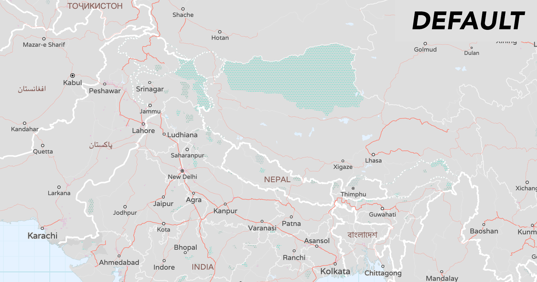
- To handle disagreements about the location of borders, the
kindmay be prefixed withunrecognized_, e.g:unrecognized_country(wasunrecognizedin v1.7),unrecognized_macroregion,unrecognized_region,unrecognized_countyfor differing viewpoints (seekind:xxbelow). -
kind:xx: alternatekindaccording to the viewpoint of country codexx. If you want to show features according to a particular viewpoint, then usekind:xxif it exists and fall back tokindif not. The range of values is the same as forkind. Note that the viewpoints are either lower-case ISO 3166-1 alpha-2 codes or the pseudo-codeiso.
-
boundaries: Add OSM alternate viewpoints for country, region, and counties boundaries. (Issue #1810)
- We track two kinds of features from OSM for indicating disputes:
-
claims, which have
boundary=claim, claimed_by=*, admin_level=*tags. These indicate borders which aren't generally recognized, but should appear in the viewpoint of theclaimed_by=value. additionally, extra viewpoints which don't make a claim for themselves but still want the claimant's view reflected in their own can be specified in arecognized_by=*tag. -
disputes which have
dispute=yesordisputed=yes, plus a list of disputant viewpoints in thedisputed_by=*tag. when a viewpoint is listed indisputed_bythen the boundary will have itskind:xxset tounrecognized_*(where XX is the viewpoint / country code and * is the kind of boundary it is).
-
claims, which have
- We track two kinds of features from OSM for indicating disputes:
-
earth: The former
OpenStreetMapData.comsource is now hosted by FOSSGIS atosmdata.openstreetmap.deand the source property has been updated. Issues (#1855) and (#1859) -
landuse: Add
kind_detailfor aerodrome enhancement and backfillkind_detailonaerodromeswith values,public,private,military_public,airfield,international,regional,gliding, and add optionalaerodrome_passenger_countproperty indicating the number of passengers through the aerodrome per year sourced from Wikidata. (Issues #1277 and #1873) -
places: Backfill
country_capitalandregion_capitalbooleans from Natural Earth on high-zoom OSM features, including point-of-view. (Issue #1810) -
places: Add point-of-view (POV) to capitals from Natural Earth data to all zooms. (Issue #1840)
-
country_capital:xx: when present, eithertrueorfalseto override thecountry_capitalvalue for XX's viewpoint. Note that the viewpoints are either lower-case ISO 3166-1 alpha-2 codes or the pseudo-codeiso, same as forkind:xxon boundaries. -
region_capital:xx: when present, eithertrueorfalseto override theregion_capitalvalue for XX's viewpoint. Note that the viewpoints are either lower-case ISO 3166-1 alpha-2 codes or the pseudo-codeiso, same as forkind:xxon boundaries.
-
-
places: Add
wikidata_idWikidata ID concordance to features. (Issue #858) -
pois: Add optional Wikidata
wikidata_idconcordances. (Issue #858) -
pois: Add
kind_detailfor aerodrome enhancement and backfillkind_detailonaerodromeswith values,public,private,military_public,airfield,international,regional,gliding. (Issues #1277 and #1873) -
pois: Distinguish military
airfieldfrom genericaerodrome. (Issue #1580) -
roads: Ensure runways get
kind_detailpolish by intersecting them with landuseaerodromepolygons using newoverlapfunction. (Issue #1852) -
roads: Add missing railway types of
disused,miniature,preserved. (Issue #955) -
water: Add optional Wikidata
wikidata_idconcordances. (Issue #858) -
water: The former
OpenStreetMapData.comsource is now hosted by FOSSGIS atosmdata.openstreetmap.deand the source property has been updated. Issues (#1855) and (#1859)
BUG FIXES
-
boundaries: Rename
unrecognizedtounrecognized_countrykind value to disambiguate POV on country, region, county, and other boundary types. - buildings: Check that building height is in a sensible range by limiting tallest structures to 1000 meters. (Issue #1850)
-
earth: Add variable
min_zoomto low zoom features from Natural Earth. (Issue #1287) - places: Update Who's On First dump to reflect new and deprecated neigbourhoods. Issues (#1808) and (#1869)
-
pois: Prefer
elevatoroversubway_entrancewhen both are true. (Issue #1876) -
pois: Prefer
memorialoverplaquewhen both are true. (Issue #1872) -
pois: Prefer
bus_stopover generic transitplatforms. (Issue #1874) -
pois: Improve the collision_rank of
fast_foodPOIs by adjusting several other's rank. (Issue #1875) -
pois: Correct generator
kind_detailvalues by using a new OpenStreetMap property. (Issue #1578):- The value of the OpenStreetMap
generator:sourcetag or, if that tag is missing, an interpolation from thegenerator:methodtag. Common values includebiofuel,biogas,biomass,coal,diesel,gas,geothermal,hydro,nuclear,oil,solar,waste,wind.
- The value of the OpenStreetMap
-
pois: Only set POI for
harbour,port,port_terminal,ferry_terminal,container_terminalwhen they aren't also tagged as waterway, natural water, or landuse reservoir, basin features. (Issue #1590) - roads: Speed up road merging, for dense areas like Japan. (Issue #1847)
-
roads: Drop all
name:*variants in addition to basicnameto promote more feature merging. (Issue #1847) -
roads: Remap Natural Earth's "trunk" roads to kind
major_roadinstead ofhighway. (Issue #1280) -
roads: Adjust
min_zoomof OpenStreetMap highways and major roads to better match Natural Earth'smin_zooms. (Issue #1279) -
roads:
min_zoomsat zoom 5 are mix of 3, 4 and 5 instead of just 5.x. (Issue #1074) -
roads: Add low-zoom
tollproperty from Natural Earth to match earlier high-zoom data from OpenStreetMap. (Issue #1817) -
roads: Add new road
constructionkind with kind_detail from the usual kind from zoom 12+. (Issue #394)-
kind_detail:motorway,motorway_link,trunk,primary,secondary,tertiary,trunk_link,unclassified,residential,road,primary_link,secondary_link,living_street,service,pedestrian,track,cycleway,bridleway,tertiary_link,footway,steps, `corridor
-
-
water: Reduce the marine water labels visible at zoom 8 by limiting number of bays in the tile to the largest 10. (Issue #1838)
- The kinds
bay,straitandfjordare ranked by size and given akind_tile_rankproperty that starts from 1 and counts up as the feature gets smaller. Note that the ranking is done on a "metatile", which means that each tile (of size 256px, 512px or other) won't necessarily contain the full range from 1 to N ofkind_tile_ranks.
- The kinds
- water: Water boundary lines now indicate intermittent property (playas), matching their polygons. (Issue #1249)
DOCUMENTATION CHANGES
- Updated TileJSON for v1.8 schema changes.
- Updated Layers documentation for v1.8 schema changes.
- Resolved some dangling TODOs from v1.7.0 documentation release.
-
traffic_incidents: Add
road_closurekind to indicate if a road has been closed, e.g. due to police presence. Thanks @conor-ettinoffe-here! (Issue #1857)
INTERNAL CHANGES
- Add
all_name_variantsparam todrop_propertiesfunction which treatsnameas if it's allname:*and variants. (Issue #1847) - Treat
NaNandInfas invalid to deal with bad OpenStreetMap import data. (Issue #1903) - Switch Natural Earth zooms to use actual
min_zoominstead ofscalerank - Fix polygon merging failure related to GEOS/Shapely polygon merging routine
unary_union. (Issue #1848) - Perform faster SQL updates by moving indexes to their own separate parallel step and add 4x sharding over
osm_idfor updates toplanet_osm_*tables. (Issue #1844) - Move more tests to generative (from live OSM data), fix a few tests
- Teach the kind parser to handle
allfilter expressions - Add
capital_alternate_viewpointtransform - Add
major_airport_detectortransform - Add
unpack_viewpoint_claimstransform - Add a
whereclause for filtering features based on their properties, withbase_whereandcutting_whereparameters. - Add pixel
toleranceto polygon merging. - Add
split_thresholdwith default of 15,000 features to line merging. - Update Who's On First import pipeline by generating WOF neigbourhoods into assets bundle (instead of stale database dump) via new
wof_snapshotscript - Add Wikidata queries to static assets via new
wikidata_mergescript. (Issue #1878) - Switch to Natural Earth v5.0.0-pre5 pre-release data assets for boundaries and places themes to support point-of-view work.
- Upgrade boto to 2.49.0 (but add and peg urllib3 to 1.24.3 as they interact)
- Add tqdm 4.31.1 requirement
-
boundaries: Add more
Published by nvkelso over 5 years ago
-
Release date: 2019-02-15.
-
Requires: tileserver v2.2.0 and tilequeue v2.3.0 and rawr_tiles v1.0.0 and coanacatl v1.0.0.
ENHANCEMENTS
-
all layers: Add
collision_rankproperty for label collisions for pois layer, and other layers for features withnameproperties, orref,shield_text,bicycle_shield_text,bus_shield_text, orwalking_shield_text. We now recommend colliding labels client side first withmin_zoom, and then to tie break with the newcollision_rankvalues. (Issue #988) -
boundaries: Adds support for alternate points of view in boundaries layer with
kind:*properties (likekind:iso). Currently this is only for zooms 5, 6 and 7 from Natural Earth. We plan to add more lower zoom data from Natural Earth, and high-zoom data from OpenStreetMap in the next release. (Issue #1552) The following country and international organizations worldviews are supported:- Argentina (
ar), Bangladesh (bd), Brazil (br), China (cn), Egypt (eg), France (fr), Germany (de), Greece (gr), India (in), Indonesia (id), Israel (il), Italy (it), Japan (jp), Morocco (ma), Nepal (np), Netherlands (nl), Pakistan (pk), Palestine (ps), Poland (pl), Portugal (pt), Russia (ru), Saudi Arabia (sa), South Korea (ko), Spain (es), Sweden (se), Taiwan (tw), Turkey (tr), United Kingdom (gb), United States (us), Vietnam (vn), ISO (iso)
- Argentina (
-
boundaries: Add new disputed boundary lines with kind values of
disputed_breakaway,disputed_claim,disputed_elusive,disputed_reference_line, from Natural Earth at low zooms, for alternate points of view (Issue #1552) - landuse: Remap landuse kinds at mid- and low-zooms to improve merging. This is similar to what we already did for roads. (Issue #1779)
-
landuse: Additional landuse kind merging at low- and mid-zooms, including to
urban_areawhich was previously low-zoom only. (Issues #1721 and #1795) -
landuse: Add new kinds for
grassland,vineyard,bare_rock,barren(low- and mid-zooms only),desert,heath,sand,shingle, and other natural "landcover" features, starting at zoom 9 (Issue #1259) -
landuse: Add
kind_detailproperty forwetlandfeatures. If available, value will be one of:bog,fen,mangrove,marsh,mud,reedbed,saltern,saltmarsh,string_bog,swamp,tidalflat,wet_meadow. (Issue #1253) -
landuse: Add
low_emission_zonekind data, added to schema in v1.6. (Issue #1553) -
pois: Add
wetlandkind, withkind_detail, see landuse item above for values. -
pois: Add
commonkind, to match the existing landuse layer polygons. -
roads: Populate data for truck
hgvrouting restriction properties and related shields (whitelisted:agricultural,delivery,designated,destination,local,no), added to schema in v1.6, includingmaxweight,maxheight,maxwidth,maxlength,maxaxleload,hazmat. (Issue #1553) -
roads: Add
tollandtoll_hgvboolean properties. (Issue #1553 -
places: Add
population_rankproperty tolocality,region,country, and other kinds useful for setting text size and colliding labels. An integar value from 0 (no population) up to 18 (over 1 billion people). See documentation for more details. -
traffic_flow: Add
road_kind_detailproperty to enable data-driven client-side traffic line offseting, thanks @zaczkows! (Issue #1829) -
traffic_flow: Add
is_hov_laneproperty to enable client-side filtering, thanks @conor-ettinoffe-here! (PR #1831) -
traffic_incidents: Add
is_hov_laneproperty to enable client-side filtering, thanks @conor-ettinoffe-here! (PR #1831)
BUG FIXES
-
landuse: Fix v1.6 regression where
aerodromepolygons sorted aboverunwayandtaxiwaypolygons in error, thanks @bcamper! (Issue #1814) -
landuse: Add additional filter for newer OSM
area:aerowaytagging ofrunway,taxiway, andapronpolygons to restore features from prior year's tile builds. (Issue #1814) -
landuse: Better differentiate between parks that should be
commoninstead ofnational_park(Issue #1082) -
landuse: Better differentiate between parks that should be
parkinstead ofnational_park(Issue #1728) -
landuse: Features of kind
mudnow sorts abovewaterand belowwetland(Issue #1753) -
landuse: Deal with US National Forest, US National Park server side performance (Issue #475)
- Harmonise kind assignment for
national_park,forest, and other low-zoom green areas. - Add
protection_titlebased filtering fornational_park. - BLM managed
protected_areasare now filtered separately in the United States.
- Harmonise kind assignment for
-
landuse: Change area grading of
nature_reserveto start zoom 8+, but demote most zoom 10 features to zoom 15. (Issue #1749) -
landuse: Show all landcover kinds consistently starting at zoom 9. (Issue #1813)
- Limit generic
forestandnatural_woodto zoom 9+. - Promote some landcover-ish landuses up a few zooms to zoom 9+, like
farmandfarmland,orchard. - Limit
residentialareas to zoom 9+.
- Limit generic
-
landuse: Adjust earliest
min_zoomfor many landcover kinds (Issue #1794)- Pushed
dam,prison,fort,range, anddanger_areakinds down to z11+. - Push down
aquarium,recreation_ground,track,sports_centre,wastewater_plant,caravan_siteto zoom 12+. - Promote some
camp_siteto zoom 12+, and area grade the rest. - Push down
harbour,port,port_terminal,ferry_terminal,container_terminalto zoom 13+. - Push down
enclosure,petting_zoo,aviary,animal,summer_toboggan,winery,allotments,pedestrian,playgroundto zoom 13+. - Push down
bridge,tower,breakwater,groyne,dike,cutlineto zoom 13+. - Push down
footway,library,fuel,cinema,theatre,runway,taxiway,apron,trail_riding_station,water_park,dog_park,picnic_site,tree_row,hedge, to zoom 13+. - Limit
quarryto zoom 13+, area graded down to zoom 16. - Limit
amusement_ride,carousel,water_slide,roller_coasterto zoom 15+. - Limit
marshto z15.
- Pushed
-
landuse: Whitelist
kind_detailvalues:- For crane related kinds:
portal_crane,gantry_crane,travel_lift,floor-mounted_crane,shiploader,tower_crane. - For religion related kinds:
animist,bahai,buddhist,caodaism,catholic,christian,confucian,hindu,jain,jewish,multifaith,muslim,pagan,pastafarian,scientologist,shinto,sikh,spiritualist,taoist,tenrikyo,unitarian_universalist,voodoo,yazidi, andzoroastrian. - For wall related kinds:
dry_stone,noise_barrier,brick,stone,pise,castle_wall,seawall,jersey_barrier,flood_wall,concrete,gabion.
- For crane related kinds:
-
pois: Fix junk
healthcarevalues and kinds introduced in v1.5. Added:chiropractor,hospice,occupational_therapist,optometrist,paediatrics,physiotherapist,podiatrist,psychotherapist,rehabilitation, andspeech_therapistkinds. (Issue #1596) -
pois: Better differentiate between parks that should be
commoninstead ofnational_park(Issue #1082) -
pois: Better differentiate between parks that should be
parkinstead ofnational_park(Issue #1728) - pois: Deal with US National Forest, US National Park server side performance, same as landcover (Issue #475)
-
pois: Prefer
forestlabels over wilderness at zoom 7 (Issue #1608) -
pois: Add
public_transport=stationwithrailway=haltas a synonym forstationkind. Require names onstationfeatures. (Issue #1747) -
pois: Match new landuse kind and
min_zoomchanges in landuse layer for "parks" at low-zooms. -
pois: Clamp POIs with unlimited
min_zoomranges to min 13. Technically affected most kinds, though actual occurrence was rare. (Issue #1750) -
pois: Limit
min_zoomfor POIs to at least match their landuse AOIs. -
pois: POIs for
parklabels shown too soon (Issue #1767) -
pois: POI labels for
parkshow up too late / too early (Issue #1081) -
pois: Too many
parkandnature_reservelabeled at zoom 10 (Issue #1609) -
pois: Hide early
cafe,restaurantkinds to zoom 15 (Issue #1632) -
pois: Hide early
post_office(Issue #1631) -
pois: Hide early
museumsandlandmarks, show z12+. (Issue #1630) -
pois: Hide early
prison, show z13+. (Issue #1630) -
pois: Hide early
atm,bus_stop,drinking_water,post_box,telephoneto zoom 18. (Issue #1626) -
pois: Hide early
parkingwhen no area, show large parking lots and garages earlier based on estimated capacity (Issue #1625) -
pois: Modify
min_zoomofbicycleto area grades from zoom 15 to 17. (Issue #1627) -
pois: Push
water_towerzoom down depending on height: zoom 15 if taller than 20 meters, zoom 16 if taller than 10 meters, else zoom 17. (Issue #1627) -
pois: Push
theatredown to z15 min. (Issue #1627) -
pois: Hide early
bicycle_parkingandcar_sharingto z19, unlesscar_sharinghas name (Issue #1624) -
pois: Hide early
militaryPOIs (Issue #1623) -
pois: Hide early
university,college(Issue #1622) -
pois: Hide early
school,kindergarten(default 17 for point geoms, arae grade polyons zoom 13+) (Issue #1621) -
pois: Hide some earlier
golf_course(Issue #1619) -
pois: Hide early
cemetery(Issue #1611) -
pois: Limit zoom range of
rangeto zoom 11+. -
pois: Limit zoom range of
quarryto zoom 13+ (Issue #1799) -
pois: Limit zoom range of
marshto zoom 15+ (Issue #1800) -
pois: Limit zoom range of
substations(varies by area) (Issue #1612) -
pois: Consolidate
graveyardandcemeteryto share same zoom ranges (Issue #1780) -
pois: Use same tier 2 zoom range for
nature_reservePOIs as the landuse polygons. - pois: Fix tier 1, 3, and 4 area thresholds to not duplicate zoom 12 test.
- pois: Fix tier3 POIs zoom 12 area threshold to 200000 (Issue #1769)
- pois: Simplify most tier 1 & 2 POI min zooms to area-based thresholds.
-
pois: Default
fitness_stationto zoom 18 instead of 17. -
pois: Whitelist
kind_detailvalues:- For crane relaed kind:
portal_crane,gantry_crane,travel_lift,floor-mounted_crane,shiploader,tower_crane. - For cuisine related kinds:
american,asian,barbecue,breakfast,burger,cake,chicken,chinese,coffee_shop,crepe,donut,fish,fish_and_chips,french,friture,georgian,german,greek,ice_cream,indian,international,italian,japanese,kebab,korean,lebanese,local,mediterranean,mexican,noodle,pizza,ramen,regional,sandwich,seafood,spanish,steak_house,sushi,tapas,thai,turkish,vegetarian,vietnamese. - For health_facility related kinds:
CSCom,chemist_dispensing,clinic,counselling_centre,dispensary,first_aid,health_center,health_centre,hospital,laboratory,medical_clinic,office,pharmacy. - For religion related kinds:
animist,bahai,buddhist,caodaism,catholic,christian,confucian,hindu,jain,jewish,multifaith,muslim,pagan,pastafarian,scientologist,shinto,sikh,spiritualist,taoist,tenrikyo,unitarian_universalist,voodoo,yazidi, andzoroastrian. - For sports related kinds:
10pin,9pin,american_football,archery,athletics,badminton,baseball,basketball,beachvolleyball,billiards,bmx,boules,bowls,canoe,chess,climbing,cricket,cricket_nets,cycling,equestrian,exercise,field_hockey,fitness,football,free_flying,futsal,gaelic_games,golf,gymnastics,handball,hockey,horse_racing,ice_hockey,ice_skating,karting,model_aerodrome,motocross,motor,multi,netball,padel,pelota,rugby,rugby_league,rugby_union,running,scuba_diving,shooting,skateboard,skating,skiing,soccer,soccer;basketball,softball,swimming,table_tennis,team_handball,tennis,trampoline,volleyball,yoga. - For wall related kinds:
dry_stone,noise_barrier,brick,stone,pise,castle_wall,seawall,jersey_barrier,flood_wall,concrete,gabion.
- For crane relaed kind:
-
boundaries: Drop
name,name:left, andname:rightfromlocalitylines at zoom 11 and 12 (Issue #1738) -
boundaries: Fix boundary
name:leftandname:rightvalues that were sometimes flipped, especially forcountryandregionfeatures (Issue #1770) -
boundaries: Made
min_zoomofcountrylines depend on the data. -
roads: Fix v1.6 regression where
runwayandtaxiwaylines were sorted below landuse layer polygons for the same in error, thanks @bcamper! (Issue #1814) -
roads: Expand
is_bridgelogic to include viaduct and any other not "no" bridges (Issue #1314) -
earth: Add
min_zoomproperties. (Issue #1073) - water: 0/0/0 tile has clipped water content (Issues #1806 and #1107)
-
water: Drop all
lakename variants zooms 0-4 (again). Drop additional lake names and variants at mid- and high-zooms (zooms 5-15) based on area. (Issue #1730) -
water: Update
min_zoomof label placement points based on their inclusion in tiles, not just their raw NE data value. - water: Extract water boundaries at zoom 8, with the switch to OSM data from NE.
-
places: Don't emit
area=0on point labels (Issue #1825) -
places: Default
countrylabels to zoom 6 instead of 1 when there isn't Natural Earth match (Issue #1826) -
places: Default
regionlabels to zoom 8 instead of 1 when there isn't Natural Earth match (Issue #1826)
DOCUMENTATION CHANGES
- Updated TileJSON for v1.7 schema changes.
- Updated Layers documentation for v1.7 schema changes.
- Publish docs to tilezen.readthedocs.io.
- Update documentation formatting for ReadTheDocs.io Markdown requirements.
- Restructure some file layout for ReadTheDocs.io build system, including:
CHANGELOG,LICENSE,CONTRIBUTING,MIGRATION_GUIDE,PERFORMANCE,SEMANTIC-VERSIONING, andTESTfiles. - Corrected order of
low_emission_zonein list. - Generalized
hgv_restrictionproperty units to mostly meters for heavy goods vehicle truck access restrictions.
INTERNAL CHANGES
- Add
gunicornto dependencies, thanks @rwrx. PR #1690 - Bump
PyYAMLversion for CVE-2017-18342. - Stop using
tags->in YAML (Issue #1199) - Add ability to make tests from relations
- Estimate
capacityfor parking lots and garages based on area and parking type with newtz_estimate_parking_capacityfunction. - Protect against
Noneshapes in way area calculation. - Add
all_the_kindsscript to output all thekindandkind_detailvalues per$layer, with theirmin_zoomfrom the YAML files. - Add whitelists to
kind_detailin each layer YAML so that we can enumerate all possible values for the script. - Extend Natural Earth test generator to support polygons.
- Use new
drop_namespost-process function to drop all the localized names (not just the default name) - Add
CollisionRankerto support YAML-based spreadsheets forcollision_ranklogic, including reserved, gaps, and filters across layers. - Add
safe_intimplementation for SQL. - Expose a test method that can return the whole tile. Used in new
collision_ranktests. - Clip to Mercator world bounds before projecting shapefiles.
- Deal with 'download only' test mode.
- Skip download only tests after downloading fixtures (if any).
- Update assets bundle for #1552 & #1809, and updated OSMdata.com land, water.
- Guard against future airport runway polygons in landuse versus runway lines in roads
sort_rankerrors with a test. - Don't create a zero area property on points in SQL templating.
- Support for multiple shapefiles in a single ZIP for asset bundle creation. (Issue #1809)
- Add support for
==operator in YAML evaluation. - Add new
drop_namesfunction to drop all name variant properties. - Add new
remapfunction to remap landuse kind values at low- and mid-zooms. - Add new
remap_viewpoint_kindsfunction remap Natural Earth's points of view to kinds (and drop null values). - Add new
add_vehicle_restrictionsfunction for hgv (heavy good vehicles) trucks. - Add new
add_collision_rankfunction. - Add new
update_min_zoomfunction. - Refactor order of landuse layer property dropping, and small inner geometry dropping for merging.
-
all layers: Add
Published by nvkelso almost 6 years ago
-
Release date: 2018-12-26.
-
Requires: tileserver v2.2.0 and tilequeue v2.2.1 and rawr_tiles v1.0.0 and coanacatl v1.0.0.
ENHANCEMENTS
-
Significant file size reductions of between 23% (p50) and 30% (p90) globally by additional geometry simplification, dropping features, dropping properties, and more aggressive merging to multi-lines and multi-polygons in low- and mid-zooms. Chart shows sizes in bytes (logarithmic scale), based on top 100,000 tiles from openstreetmap.org logs at 512 pixel zoom. NOTE: all other zooms in this document use nominal 256 pixel zooms, offset by 1).

- boundaries: Merge lines with same properties into multi-lines, at most zooms. Issue #1683.
-
boundaries: Strip long
name,name:left, andname:rightproperties from boundaries when geometry length can't fit the text, at mid-zooms (<11), to enable merging. Issue #1683. -
boundaries: Remove
id,id:leftandid:rightproperties at low- and mid-zooms (<13), to enable merging. Issue #1715. -
boundaries: Push
localitylines down tomin_zoom11 (was 10), to reduce file size. Issue #1715. - boundaries: Double simplification tolerance. Issue #641 and PR #1718.
-
buildings: Improve polygon merging at zooms 13, 14, and 15 including via aggregation of adjacent features. Remove some mid-zoom content at zoom 13 and 14, and refactor
min_zoom. Issues #1686 and #1732 PR #1689, #1704, and PR #1739 - earth: Simplify at zoom 8 to match the transition from Natural Earth to OpenStreetMap, significantly reducing file size at that zoom. Issue #1477 and PR #1714.
-
earth: Truncate
min_zoomfloats to tenths place (and often just ints), to improve merging. Issue #1477 and PR #1714. -
landuse: Add
allotments(community gardens), was already in POIs layer. PR #1742 -
landuse: Add
boatyardand military firingrangepolygons, they already had POIs. PR #1720. -
places: Use the Natural Earth v4.1
min_zoomproperty to cull more places at low-zooms, and reduce tile overpacking. Issue #1687 and PR #1693 and PR #1734. Issue #1729 -
pois: Add
turning_circleandturning_loop, thanks @westnordost. Issue #1695. - roads: Add cross-junction and multi-pass merging to remove more vertices and reduce overall feature count, thanks @bcamper. Issue #1227, PR #1703, PR #1706, PR #1708, PR #1718.
- roads: Double simplification tolerance. Issue #641 and PR #1718.
-
roads: Reduce precision of
surfacetags at mid-zooms to justpaved,compacted, andunpavedto increase road merging. Thanks @matkoniecz. Issue #1716. -
roads: Drop some properties from
minor_roadkind features at mid zooms to increase merging, including:colour,cutting,embankment,motor_vehicle,operator,route,route_name,state,symbol,type. Issue #1331 and PR #1710. -
roads: Drop
all_networksandall_shield_textsproperties from roads at low- and mid-zooms, to increase merging. Issue #1642. -
roads: Drop
all_bicycle_networksandall_bicyle_shield_textsuntil the max zoom, for all network types, to increase merging. Issue #1331 and PR #1707. -
roads: Drop
bicycle_networkandbicycle_shield_textfrom some mid-zooms depending on network type, to increase merging. Issue #1331 and PR #1707. - water: Merge water lines with same properties to improve labeling and rendering, thanks @sensescape. Issue #1135.
- water: Simplify at zoom 8 to match the transition from Natural Earth to OpenStreetMap, significantly reducing file size at that zoom. Issue #1477 and PR #1714.
-
water: Drop
nameproperty when it doesn't fit on feature at all zooms but max, to improve merging. Issue #1477 and PR #1714. - water: Drop smaller water polygons across at all zooms but max. Issue #1477 and PR #1714.
-
water: Truncate
min_zoomfloats to tenths place (and often just ints), to improve merging. Issue #1477 and PR #1714.
BUG FIXES
- boundaries: Drop buffered land polygons from low zooms introduced in v1.5 in error. PR #1699.
-
landuse: Update and/or add sort_rank for
airfield,boatyard,container_terminal,danger_area,embankmentlines,ferry_terminal,natural_forest,natural_park,natural_wood,naval_base,port_terminal,quay,range,shipyard,wetland, andwharf. Some other kinds are also affected due to sort_rank ordering. Issues #1096, #1588, #1574, and #1569. -
pois: Allow no-name
drinking_waterandplaygroundfeatures. -
pois: Remove bogus
service_areaandrest_areafeatures at mid zooms. Issue #1698. -
pois: Refine
min_zoomforpitch,playground, andbicycle_parkingif they have a name, and push back no-name to a later zoom. Modifymin_zoomfordrinking_waterandtraffic_signals. Issue #1638 and PR #1727 -
pois: Modify
min_zoomofnursing_homeuntil z15. Issue #1634. -
pois: Modify default
min_zoomofgarden,allotments, anduniversity. Issue #1636. -
pois: Modify default
min_zoomof tram stops, railway stops, and railway halts down to zoom 16. Issue #1635 -
pois: Modify default
min_zoomof earlywood&platform. Issue #1637 - water: Remove water point labels generated from lines. Issue #1702.
DOCUMENTATION CHANGES
- Updated Layers documentation for v1.6 schema changes.
- roads: Document new heavy good vehicle (hgv, or truck) properties in schema (but not yet added to tile content), thanks @musculman at HERE! Issue #1553.
- traffic_flow: Add new optional layer definition, thanks @conor-ettinoffe-here at HERE! Issue #1598 and PR #1705.
- traffic_incidents: Add new optional layer definition, thanks @conor-ettinoffe-here at HERE! Issue #1598 and PR #1705 and PR #1719.
- Updated
tilejsonfor v1.5 and v1.6 schema changes.
INTERNAL CHANGES
- Add gunicorn to dependencies, thanks @rwrx. PR #1690
- Use raw strings for regular expressions containing regular expression. 4b2075.
- Refactor common properties for
{bi|motor}cycle_parkingin YAML code. - Represent numbers as numbers (not strings), and allow strings not just Unicode strings. PR #1744
- Update simplification process, address bugs. d66f43
- NOTE: No database migrations were provided, v1.5 was the last version that included those, as we've migrated to global RAWR tile builds.
-
Significant file size reductions of between 23% (p50) and 30% (p90) globally by additional geometry simplification, dropping features, dropping properties, and more aggressive merging to multi-lines and multi-polygons in low- and mid-zooms. Chart shows sizes in bytes (logarithmic scale), based on top 100,000 tiles from openstreetmap.org logs at 512 pixel zoom. NOTE: all other zooms in this document use nominal 256 pixel zooms, offset by 1).
Published by nvkelso about 6 years ago
-
Release date: 2018-09-21.
-
Requires: tileserver v2.2.1 and tilequeue v2.1.0 and rawr_tiles v1.0.0 and coanacatl v1.0.0.
ENHANCEMENTS
-
buildings: add
entrancepoints, with optional kind_detail property with values:garage,home,main,private,residence,secondary,service,staircase, orunisex. -
buildings: add
exitpoints, with optional kind_detail property with values:emergencyorfire_exit. - buildings: all building polygons are now clipped to tile boundaries, which fixes missing landuse_kind values. Issue #1226 and #1142 and #487.
-
buildings: Add building_material optional property to describe the material covering the outside of the building or building part. Common values are:
brick,cement_block,clay,concrete,glass,masonry,metal,mud,other,permanent,plaster,sandstone,semi-permanent,steel,stone,timber-framing,tin,traditionalandwood. Issue #1408. - landuse: Add new kind values (listed below) to support full compatibility with OSM.org #1425 map style.
-
landuse: Add kind_detail for
woodandforestkinds with values indicating leaftype:broadleaved,leafless,mixed,needleleaved. -
landuse: Add kind_detail optional property for
beachkind to indicate surface values of:grass,gravel,pebbles,pebblestone,rocky,sand. -
landuse: Add kind_detail optional property for
wetlandwhen wetland isbog,fen,mangrove,marsh,mud,reedbed,saltern,saltmarsh,string_bog,swamp,tidalflat,wet_meadow. -
landuse: Add kind_detail optional property for
cemeteryandgrave_yardkinds, with common values:animist,bahai,buddhist,caodaism,catholic,christian,confucian,hindu,jain,jewish,multifaith,muslim,pagan,pastafarian,scientologist,shinto,sikh,spiritualist,taoist,tenrikyo,unitarian_universalist,voodoo,yazidi, andzoroastrian. -
landuse: Add denomination optional property for
cemeteryandgrave_yardkinds, with common values:adventist,anglican,armenian_apostolic,assemblies_of_god,baptist,buddhist,bulgarian_orthodox,catholic,christian,church_of_scotland,episcopal,evangelical,greek_catholic,greek_orthodox,iglesia_ni_cristo,jehovahs_witness,lutheran,mennonite,methodist,mormon,new_apostolic,nondenominational,orthodox,pentecostal,presbyterian,protestant,quaker,reformed,roman_catholic,romanian_orthodox,russian_orthodox,salvation_army,serbian_orthodox,seventh_day_adventist,shia,shingon_shu,sunni,theravada,tibetan,united,united_methodist,united_reformed,uniting, and曹洞宗. -
landuse: Add
airfieldkind for military airfields. -
landuse: Add
container_terminalkind. -
landuse: Add
cranekind as line geometry. Issue #1417. -
landuse: Add
cuttingkind. -
landuse: Add
danger_areakind for military. -
landuse: Add
ditchkind as line geometry. -
landuse: Add
embankmentkind. -
landuse: Add
fencekind lines with optional kind_detailavalanche,barbed_wire,bars,brick,chain,chain_link,concrete,drystone_wall,electric,grate,hedge,metal,metal_bars,net,pole,railing,railings,split_rail,steel,stone,wall,wire,wood. -
landuse: Add
ferry_terminalkind. -
landuse: Add
guard_railkind as line geometry. -
landuse: Add
harbourkind. -
landuse: Add
kerbkind as line geometry. -
landuse: Add
mudkind. -
landuse: Add
naval_basekind for military. -
landuse: Add
orchardkind with optional kind_detail values:agave_plants,almond_trees,apple_trees,avocado_trees,banana_plants,cherry_trees,coconut_palms,coffea_plants,date_palms,hazel_plants,hop_plants,kiwi_plants,macadamia_trees,mango_trees,oil_palms,olive_trees,orange_trees,papaya_trees,peach_trees,persimmon_trees,pineapple_plants,pitaya_plants,plum_trees,rubber_trees,tea_plants,walnut_trees. -
landuse: Add
pierpolygon when's used for mooring. -
landuse: Add
plant_nurserykind. -
landuse: Add
port_terminalkind. -
landuse: Add
portkind. -
landuse: Add
power_linekind as line geometry. Issue #232 -
landuse: Add
power_minor_linekind as line geometry. Issue #232 -
landuse: Add
quaykind -
landuse: Add
shipyardkind. -
landuse: Add
wallkind as line geometry. Issue #1403. -
landuse: Add
wharfkind - places: Add locality name translations for ~21 languages at low zooms from Natural Earth. Issue #977.
-
places: Lookup min_zoom for
country,map_unit, andregionfrom Natural Earth while continue sourcing feature names from OpenStreetMap. - pois: Add over hundred new kind values (listed below) to support full compatibility with OSM.org and iD #1425, Maki #1423, and Humanitarian OpenStreetMap (HOT) #1424 icon libraries. A continuation of work started in v1.4.3.
- pois: Add attraction optional property for all kinds.
-
pois: Add drives_on_left optional boolean property for
mini_roundaboutkind features. Issue #1498. - pois: Add exit_to optional property for all kinds.
-
pois: Add kind_detail optional property for kind
beachwith surface values of:grass,gravel,pebbles,pebblestone,rocky,sand. -
pois: Add kind_detail optional property for kinds
cemeteryandgrave_yardto indicate the religion. See landuse description above for values. -
pois: Add denomination optional property for kinds
cemeteryandgrave_yardto indicate the denomination. See landuse description above for values. -
pois: Add kind_detail optional property for kinds
clinic,dentist,doctors,healthcare,hospital,nursing_home,pharmacy,social_facility, andveterinarywith values:office,dispensary,clinic,laboratory,health_centre,hospital,health_center,CSCom,first_aid,pharmacy,chemist_dispensing,counselling_centre,medical_clinic. -
pois: Add kind_detail optional property for kind
generatorto indicate method ofanaerobic_digestion,barrage,combustion,fission,gasification,photovoltaic,run-of-the-river,stream,thermal,water-pumped-storage,water-storage,wind_turbine. -
pois: Add kind_detail optional property for kind
toiletto indicatepit_latrine,flush,chemical,pour_flush,bucket. -
pois: Add kind_detail optional property for kind
water_wellwith optional values:drinkable_powered,drinkable_manual,drinkable_no_pump,drinkable,not_drinkable_powered,not_drinkable_manual,not_drinkable_no_pump,not_drinkable. - pois: Add ref optional property for all kinds.
-
pois: Add sanitary_dump_station optional property on existing
marina,camp_site, andcaravan_sitekind features with values:yes,customers, orpublic. - pois: Add zoo optional property for all kinds.
-
pois: Add
adult_gaming_centrekind. -
pois: Add
airfieldkind for military features. -
pois: Add
ambulatory_carekind. -
pois: Add
arts_centrekind. -
pois: Add
atvkind for shops. -
pois: Add
baby_hatchkind. -
pois: Add
blood_bankkind. -
pois: Add
boat_liftkind. -
pois: Add
boatyardkind. -
pois: Add
bookmakerkind. -
pois: Add
border_controlkind. -
pois: Add
bunkerkind for military features, with optional kind_detail values:pillbox,munitions,gun_emplacement,hardened_aircraft_shelter,blockhouse,technical,mg_nest,missile_silo -
pois: Add
bureau_de_changekind. -
pois: Add
camerakind for shops. -
pois: Add
car_partskind for shops. -
pois: Add
car_rentalkind. -
pois: Add
car_washkind. -
pois: Add
casinokind. -
pois: Add
charging_stationkind and indicate boolean properties for bicycle, car, truck, and scooter usage. -
pois: Add
charitykind. -
pois: Add
chemistkind for shops. -
pois: Add
container_terminalkind. -
pois: Add
copyshopkind. -
pois: Add
cosmeticskind for shops. -
pois: Add
cranekind with optional kind_detail to indicate the type of crane, including:container_crane,floor_mounted_crane,gantry_crane,portal_crane,travellift. Issue #1417. -
pois: Add
customskind. -
pois: Add
danger_areakind for military features. -
pois: Add
defibrillatorkind. -
pois: Add
dispensarykind. -
pois: Add
elevatorkind. -
pois: Add
field_hospitalkind with optional kind_detail to indicate heath care facility type. -
pois: Add
fire_hydrantkind -
pois: Add
fishmongerkind. -
pois: Add
funeral_directorskind. -
pois: Add
gamblingkind. -
pois: Add
garden_centrekind. -
pois: Add
golfkind. -
pois: Add
grocerykind. -
pois: Add
harbourmasterkind. -
pois: Add
health_centrekind. -
pois: Add
healthcare_alternativekind. -
pois: Add
healthcare_centrekind. -
pois: Add
healthcare_laboratorykind. -
pois: Add
heliportkind. -
pois: Add
horse_ridingkind. -
pois: Add
hunting_standkind. -
pois: Add
karaoke_boxkind. -
pois: Add
karaokekind. -
pois: Add
lotterykind. -
pois: Add
love_hotelkind at zoom 18+. -
pois: Add
marketplacekind. -
pois: Add
miniature_golfkind. -
pois: Add
money_transferkind. -
pois: Add
mooringkind with optional kind_detail values ofcommercial,cruise,customers,declaration,ferry,guest,pile,waiting,yacht,yachtsand optional access property with values:privateorpublic. -
pois: Add
motorcycle_parkingkind. -
pois: Add
naval_basekind for military features. -
pois: Add
nightclubkind. -
pois: Add
obeliskkind with a variable zoom according to it's height. This kind takes precidence overartwork,monument, andmemorial. Optional kind_detail indicates if feature is also amonumentormemorial. -
pois: Add
parking_garagekind by subdividing existingparking, when parking type ismulti-storey,underground, orrooftop. -
pois: Add
photokind. -
pois: Add
plaquekind. -
pois: Add
port_terminalkind. -
pois: Add
quaykind. -
pois: Add
rangekind for military features. -
pois: Add
sanitary_dump_stationkind. -
pois: Add
ship_chandlerkind. -
pois: Add
shipyardkind. -
pois: Add
slaughterhousekind. -
pois: Add
slipwaykind with optional mooring property. -
pois: Add
snowmobilekind. -
pois: Add
street_lampkind. -
pois: Add
studiokind, with optional kind_detail valuesaudio,cinema,photography,radio,television,video. -
pois: Add
taxikind for taxi stands. -
pois: Add
tyreskind. -
pois: Add
waterway_fuelkind. -
pois: Add
wayside_crosskind. -
pois: Add
wharfkind. -
pois: Add additional
ferry_terminalkind features by expanding upstream filters. -
pois: Add catchall
craftkind when there isn't a more specific kind. -
pois: Add catchall
industrialkind when there isn't a more specific kind. -
pois: Add catchall
officekind when there isn't a more specific kind. -
pois: Add catchall
shopkind when there isn't a more specific kind. -
pois: Allow additional kind values to show up on the map when they lack a name:
boat_lift,boatyard,border_control,bunker,bureau_de_change,car_rental,car_wash,charging_station,crane,customs,defibrillator,field_hospital,fire_hydrant,harbour_master,harbourmaster,health_centre,hunting_stand,karaoke_box,money_transfer,motorcycle_parking,obelisk,power_generator,sanitary_dump_station,street_lamp,taxi,waterway_fuel, andwayside_cross. -
pois: Modify min_zoom of
alpine_hutkind to reveal them two zooms earlier at zoom 13. Issue #1407. -
pois: Modify min_zoom of
lighthousekind when they are ruins but also attractions. -
pois: Modify min_zoom of
watermillkind when they are ruins but also attractions. -
pois: Remove abandoned or disused
watermillkind features (but keep the majority of features). -
pois: Stop emitting covered boolean property when the value was false on
bicycle_parkingandmotorcycle_parkingkind features. -
roads: Add access optional property with common values:
private,yes,no,permissive,customers,destination. Issue #1273. -
roads: Add cutting optional property with values:
yes,right, andleft. -
roads: Add embankment optional property with values:
yes,right, andleft. -
roads: Add mooring optional property for new
quayand existingpierkinds with values: ['no', 'yes', commercial, cruise, customers, declaration, ferry, guest, private, public, waiting, yacht, yachts] -
roads: Add
quaykind lines. -
roads: Major changes to network and shield_text to support localized road shields globally, including (but not limited to), with uppercase 2-char country code prefixes:
AM:AM,AR:national,AR:provincial,AsianHighway,AT:A-road,AU:A-road,AU:B-road,AU:C-road,AU:M-road,AU:Metro-road,AU:N-route,AU:R-route,AU:S-route,AU:T-drive,BE:A-road,BE:N-road,BE:R-road,BR:AC,BR:AL,BR:AM,BR:AP,BR:BA,BR:BR,BR:CE,BR:DF,BR:ES,BR:GO,BR:MA,BR:MG:local,BR:MG,BR:MS,BR:MT,BR:PA,BR:PB,BR:PE,BR:PI,BR:PR,BR:RJ,BR:RN,BR:RO,BR:RR,BR:RS,BR:SC,BR:SE,BR:SP:PLN,BR:SP:SCA,BR:SP,BR:TO,BR:Trans-Amazonian,BR,CA:AB:primary,CA:AB:trunk,CA:AB,CA:BC:primary,CA:BC:trunk,CA:BC,CA:MB:PTH,CA:MB,CA:NB2,CA:NB3,CA:NB,CA:NS:R,CA:NS:T,CA:NT,CA:ON:primary,CA:ON:secondary,CA:PEI,CA:QC:A,CA:QC:R,CA:SK:primary,CA:SK:secondary,CA:SK:tertiary,CA:transcanada,CA:yellowhead,CA:YT,CD:RRIG,CH:motorway,CH:national,CH:regional,CL:national,CL:regional,CN:expressway:regional,CN:expressway,CN:JX,CN:road,CZ:national,CZ:regional,DE:BAB,DE:BS,DE:Hamburg:Ring,DE:KS,DE:LS,DE:STS,DE,DK:national,e-road,ES:A-road,ES:autonoma,ES:city,ES:N-road,ES:province,ES,FR:A-road,FR:D-road,FR:N-road,FR,GA:L-road,GA:national,GB:A-road-green,GB:A-road-white,GB:B-road,GB:M-road,GB,GR:motorway,GR:national,GR:provincial,GR,HU:national,ID:national,IN:MDR,IN:NH,IN:SH,IR:freeway,IR:national,IT:A-road,IT:B-road,IT,JP:expressway,JP:national,JP:prefectural,JP,KR:expressway,KR:local,KR:metropolitan,KR:national,KZ:national,KZ:regional,LA:national,MX:AGU,MX:BCN,MX:BCS,MX:CAM,MX:CHH,MX:CHP,MX:CMX:EXT,MX:CMX:INT,MX:COA,MX:COL,MX:DUR,MX:GRO,MX:GUA,MX:HID,MX:JAL,MX:MEX,MX:MIC,MX:MOR,MX:NAY,MX:NLE,MX:OAX,MX:PUE,MX:QUE,MX:ROO,MX:SIN,MX:SLP,MX:SON,MX:TAB,MX:TAM,MX:VER,MX:YUC,MX:ZAC,MY:expressway,MY:federal,MY:JHR,MY:KDH,MY:KTN,MY:MLK,MY:NSN,MY:PHG,MY:PLS,MY:PNG,MY:PRK,MY:SBH,MY:SGR:municipal,MY:SGR,MY:SWK,MY:TRG,NL:A-road,NL:N-road,NO:fylkesvei,NO:oslo:ring,NO:riksvei,NZ:SH,NZ:SR,PE:AM,PE:AN,PE:AP,PE:AR,PE:AY,PE:CA,PE:CU,PE:HU,PE:HV,PE:IC,PE:JU,PE:LA,PE:LI,PE:LM,PE:LO,PE:MD,PE:MO,PE:PA,PE:PE,PE:PI,PE:PU,PE:SM,PE:TA,PE:TU,PE:UC,PH:NHN,PK,PL:expressway,PL:motorway,PL:national,PL:regional,PT:express,PT:motorway,PT:municipal,PT:national,PT:primary,PT:rapid,PT:regional,PT:secondary,PT,RO:county,RO:local,RO:motorway,RO:national,RU:national,RU:regional,SG:expressway,TR:highway,TR:motorway,TR:provincial,UA:international,UA:national,UA:regional,UA:territorial,VN:expressway,VN:national,VN:provincial,VN:road,ZA:kruger,ZA:metropolitan,ZA:national,ZA:provincial,ZA:regional, andZA:S-road. -
roads: Major changes to network and shield_text to support fallback international road shields. When no network is provided by a ref is, a 2-char country code will be exported as the network value based on the location of the road, like
AMorUS. Issue #135. -
roads: Minor changes to network and shield_text to support USA road shields, including modifier postfix:
US:AK,US:AL,US:AR,US:AZ,US:BIA,US:BLM,US:CA,US:CO,US:CT,US:DC,US:DE,US:FL,US:FSH,US:FSR,US:GA,US:HI,US:I:Alternate,US:I:Business,US:I:Bypass,US:I:Connector,US:I:Historic,US:I:Scenic,US:I:Spur,US:I:Toll,US:I:Truck,US:I,US:IA,US:ID,US:IL,US:IN,US:KS,US:KY,US:LA,US:MA,US:MD,US:ME,US:MI,US:MN,US:MO,US:MS,US:MT,US:NC,US:ND,US:NE,US:NH,US:NJ,US:NM,US:NV,US:NY,US:OH,US:OK,US:OR,US:PA,US:RI,US:SC,US:SD,US:TN,US:TX,US:US:Alternate,US:US:Business,US:US:Bypass,US:US:Connector,US:US:Historic,US:US:Scenic,US:US:Spur,US:US:Toll,US:US:Truck,US:US,US:UT,US:VA,US:VT,US:WA,US:WI,US:WV, andUS:WY. Issue #1387. -
roads: Modify min_zoom of
trackkind to show 1 zooms earlier by default when surface isgravelor tracktype is notgrade3,grade4, orgrade5. Issue #1251. -
roads: Modify min_zoom of
trackkind to show 2 zooms earlier by default when surface ispaved,asphalt,concreteor tracktype isgrade1(but not for accessprivate). Issue #1251. -
roads: Modify min_zoom of
unclassifiedkind to show 1 zoom earlier by default. Issue #1250. -
roads: Show important cycling and walking routes at earlier zooms by adjusting the
min_zoomofpath,major_road, andminor_roadkinds. This means thatmin_zoomvalues are now variable for features of the same kind, depending on their importance in the bicycle and walking networks; in earlier releases they all shared the samemin_zoom. See #1172. -
water: Add
fountainkind. -
water: Add
reefkind, with optional kind_detail values ofcoral,rock, andsand.
BUG FIXES
- boundaries: Restore full border to Gaza Strip. Issue #1257.
- landuse: MVT format now includes many more polygons that were dropped in earlier versions that used different format driver.
- places: Fix spelling of ~60 locality (city) names at low-zooms in places layer by taking Natural Earth update. #1140.
- roads: European primary network calculation now prefers local networks instead of e-road. Issue #1483.
- roads: Add surface property at more zooms. Issue #1252.
-
water: Fix missing ocean water by making Natural Earth
ne_10m_oceanfeatures OGC valid in PostGIS.
DOCUMENTATION CHANGES
- Correct the Greek language 2-char code from
grtoelin the Semantic Versioning statement. - Change references to Mapzen (RIP) to Tilezen.
- Update MapboxGL demo, thanks to Apollo Mapping
- Use service wording changes (Less > Fewer)
- Updated Layers documentation for v1.5 schema changes.
- TODO: Updated tilejson/tilejson.json.erb for v1.5 schema changes.
INTERNAL CHANGES
- Change references to Who's On First gazetteer source to
whosonfirst.orgfromwhosonfirst.mapzen.com. - Refactors to support RAWR tile builds in queries/jinja and elsewhere.
- Add support for multiple localized names from Natural Earth 4.x by adding new transform
convert_ne_l10n_namefor 2-char language codes. - Use a Tilezen curated country admin polygon layer to determine country codes PIP for intermediate processing (this layer is not exported in final tiles).
- Add new function to calculate linear overlap with polygons, useful for road in country calculation.
- Add new function to calculate point in polygon (PIP), useful in POI in country calculation.
- Updates to Tilezen curated buffered_land layer for marine boundary lines.
- Be more robust to only add database columns when they don't already exist.
- Support easier creation of generative tests for points, lines, and polygons.
- Continued migration to generative tests instead of live-data OpenStreetMap tests via Overpass.
- Switch to generating MVT format with Coanacatl, which wraps Wagyu and VTZero.
- Requires Postgresql 9.5. Issue #1319.
- Upgrade to CircleCI 2.0 for continuous integration.
- Refactor all OpenStreetMap to Tilezen ETL logic for
networkandref>shield_textto support international road shields based on fuzzy data and missing country code data, including specific functions per country. - Add
max_zoom_filterto remove features with amax_zoomif it's <nominalzoom. - Add whitelist for fence
kind_detailvalues. - This will be the last set of database migrations provided. All future releases will assume "global" RAWR tile builds.
-
buildings: add
Published by nvkelso about 6 years ago
- Release date: 2018-01-08.
- RAWR internal pre-release round 2.
- Clip buildings to tile boundaries. See #1142.
- Allow some kinds of non-numeric
shield_text. See #1452. - Add shops from osm.org and iD. See #1447.
- Clip buildings to tiles. See #1446.
- Include all name variants. See #1454.
- Add building material tag to output. See #1455.
- Add route modifier information to network. See #1460.
- Add wetland detail to `kind_detail. See #1461.
- Remove unused wooded area tags + natural=park and add leaf_type kind_detail to wooded areas. See #1459.
- Guard against TopologicalError. See #1471.
Published by zerebubuth almost 7 years ago
- RAWR internal pre-release.
Published by rmarianski about 7 years ago
- Release date: 2017-10-23.
- Requires: tileserver v2.1.1 and tilequeue v1.8.1 and mapbox-vector-tile v1.2.0.
- Backport fix for including VERSION file in package. See #265.
- Point tilequeue/tileserver to specific versions in requirements.
Published by nvkelso about 7 years ago
- Release date: 2017-09-20. Live on prod 2017-09-??.
- Requires: tileserver v2.1.0 and tilequeue v1.9.0 and mapbox-vector-tile v1.2.0.
Published by nvkelso over 7 years ago
- Release date: 2017-06-28. Live on prod 2017-06-??.
- Requires: tileserver v2.1.0 and tilequeue v1.9.0 and mapbox-vector-tile v1.2.0.
- [docs] Update link to pois.jinja2. See #1268.
- [docs] Update
your-mapzen-api-keyURL query strings to enable key substitution. See #1275. - [docs] Spelling, grammar, writing style fixes. See #1275.
- [docs] Add documentation for 512 pixel tile sizes. See #1284.
- [docs] Add documentation to suggest max zoom (per tile size). See #1161.
- [docs] Add documentation for tile x, y coordinates (versus latitude and longitude). See #1111.
- [docs] Add documentation for HTTP status codes. See #1266.
- [tests] Update tests for upstream OpenStreetMap data churn. See #1267, #1282, and #1286.
- Remove duplicate symbol output. See #1265.
- Fixed release notes on 2017-07-19 and 2017-07-25 with corrected Requires section.
Published by nvkelso over 7 years ago
- Release date: 2017-05-31.
- Requires: tileserver v2.1.0 and tilequeue v1.8.0 and mapbox-vector-tile v1.2.0.
Published by nvkelso over 7 years ago
-
Release date: 2017-05-04. Live on prod 2017-05-08.
-
Requires: tileserver v2.0.0 and tilequeue v1.7.0 and mapbox-vector-tile v1.2.0.
ENHANCEMENTS
- Show important cycling and walking routes at earlier zooms by adjusting the
min_zoomofpath,major_road, andminor_roadcycling and walking related features in the roads layer. This means thatmin_zoomvalues are now variable for features of the same kind, depending on their importance in the bicycle and walking networks; in earlier releases they all shared the samemin_zoom. See #1172. - Add shields for bicycle, walking, and bus networks with new
bicycle_network,walking_network,bus_network,bicycle_shield_text,walking_shield_text,bus_shield_text, andall_*variants onto road layer features. See #775, #1175, and #1214. - Add
bicycleproperty to non-path road layer features to more accurately reflectis_bicycle_relatedroutes (eg for ways taggedbicycle=designated). See #1171. - Add
surfaceproperty to roads layer features. See #1020. - Add
rampandramp_bicycleproperty to roads layer features. See #1147. - Remove
motor_vehicle,horseand some other properties at low- and mid-zooms in roads layer. See #1224 and #1214. - Improve line merging in roads and other layers to reduce tile file size and improve rendering performance. See #1191.
- Add
colour_nameproperty for transit layer features. See #1190. - Show large piers earlier in landuse layer. See #1178.
- Remove many pois layer features when they lack a name (but many others are whitelisted as no-name okay). See #1186 and #1218.
BUG FIXES
- Fix spelling of ~60 locality (city) names at low-zooms in places layer. #1140.
- Small gardens (in Edinburgh and elsewhere) should not be visible at mid-zooms in pois layer. #1185.
- Some pois layer features were missing their
tierproperty. See #1208. - Remove
natural_forest,natural_wood, andvillage_greenfrom pois layer, a documented breaking bug fix associated with the v1.0 release. Their label points are now found in the landuse layer. See #1103. - Fix test failures based on upstream OpenStreetMap data changes.
- Show important cycling and walking routes at earlier zooms by adjusting the
Published by rmarianski over 7 years ago
- Release date: 2017-05-04.
- Requires: tileserver v1.4.0 and tilequeue v1.6.0 and mapbox-vector-tile v1.2.0.
- Guard against network being None in more ways
Published by nvkelso over 7 years ago
- Release date: 2017-05-04.
- Requires: tileserver v1.4.0 and tilequeue v1.6.0 and mapbox-vector-tile v1.2.0.
- Guard against network being None
Published by rmarianski over 7 years ago
v1.3.0-docs1
- Release date: 2017-05-05. Live on prod 2017-05-??.
- Requires: tileserver v2.0.0 and tilequeue v1.7.0 and mapbox-vector-tile v1.2.0.
- [docs] Delete api-keys-and-rate-limits.md page
- [docs] Update attribution.md page with less Mapzen
- [docs] Add
your_mapzen_api_keyURL query strings to URL endpoint examples - [changelog] Update mapbox-vector-tile pypi urls
- [tests] island > islet for OSM data change
Published by rmarianski over 7 years ago
- Release date: 2017-03-23.
- Requires: tileserver v1.4.0 and tilequeue v1.6.0 and mapbox-vector-tile v1.2.0.
- Generate less-complex MultiPolygons by limiting the number of features that can be merged into a single MultiPolygon (defaults to 1000). This can have a large impact on geometric topology checks for file formats like MVT. See #1176.
- Move merging of landuse polygons after roads intercut, to improve intercut performance. See #1177.
- Drop small inner polygons, to improve downstream performance. See #1180.
- Fix test failures based on OpenStreetMap data changes and 2x2 metatiles where unit of work for some operations like
tile_kind_rankis now 512px instead of 256px. See #1182.
Published by rmarianski over 7 years ago
- Release date: 2017-02-17.
- Requires: tileserver v1.3.0 and tilequeue v1.4.0 and mapbox-vector-tile v1.0.0.
- Replace usage of tile coordinate with usage of nominal zoom. (See https://github.com/tilezen/vector-datasource/pull/1166)
- Fix test failures.
Published by nvkelso over 7 years ago
- Release date: 2017-01-24.
- Requires: tileserver v1.1.0 and tilequeue v1.2.0 and mapbox-vector-tile v1.0.0.
- Clarify documentation license as CC-BY. See #1136.
- Fix test failures. See #1148, #1150, #1152, #1157.
Published by nvkelso almost 8 years ago
- [docs] Automatic docs precog previews for master and prod go-live for latest tagged release (excluding pre-release).
Published by nvkelso almost 8 years ago
- Release date: 2016-11-17. Prod go live: 2016-11-21.
- Requires: tileserver v1.0.0 and tilequeue v1.0.1 and mapbox-vector-tile v1.0.0.
- Merge water and earth polygons. See #1106.
- Improve maritime_boundary tagging in Europe and globally by updating buffered_land shapefile. See #294.
